
Tuesday, April 28, 2015
Project Complete!
Hi everyone! After several late nights in the GIS Lab and lots of hours spent editing, I FINALLY finished my poster! (See picture below) Hope you enjoy it and feel free to comment!
Friday, April 17, 2015
A Late Night Update
Hi blog followers! As promised, I FINALLY have a visual aid prepared for you! Below is a map showing the locations of motor vehicle/bicyclist accidents that occurred in Albany County from 2010 to present day. Although my final map will include other layers, I figured this was a good place to start. Enjoy!

Thursday, April 16, 2015
Project Update #5
Hi again everyone! First off, I want to apologize for my long hiatus from updating this blog. My busy schedule has distracted me from thinking in the long-term. Despite this, I DID manage to obtain the accident data! After receiving an email that the records I requested were available last Thursday, I went to the NYSDOT offices on Wolf Road to pick them up in person. Right now I am still editing my excel spreadsheet, but once I finish doing that, I should have a draft map for you to look at!
Tuesday, March 24, 2015
Project Update #4
Okay folks, so I have some good news and some bad news. The bad news is that I STILL have not been able to obtain the accident data from the NYS Department of Transportation... nor have I heard back from the Albany Bicycling Coalition! That said, it will probably be another week or so before I get a solid draft of my map completed. HOWEVER, the good news is that despite my issues with acquiring data, I was still able to make some progress on my project over the past few days! On top of finding some relevant maps from the Capital District Transportation Coalition's website, I sent in an official FOIL request to the Department of Transportation! Below are some screenshots and/or links to the maps I found today:
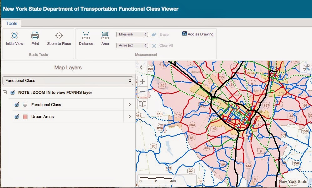
Map 1- "NYS Department of Transportation Functional Class Viewer."
Map 3- "Mohawk-Hudson Bike-Hike Map: Albany to Cohoes Section"
Link= http://www.cdtcmpo.org/mohhudns.pdf
Map 4- "Mohawk-Hudson Bike-Hike Map: Cohoes to Rotterdam Junction Section"
Link= http://www.cdtcmpo.org/mohhudew.pdf
Map 5- "CDTC's Bicycle Pedestrian Priority Network"
Link= http://www.cdtcmpo.org/networks/bikeped.pdf
Since many of these maps were created using arcgisonline, my goal is to find a way to transfer some of their layers into my own ArcMap document! Needless to say, I have quite a bit of work to do over the next couple of days!
Until next time,
-Christie
Map 1- "NYS Department of Transportation Functional Class Viewer."
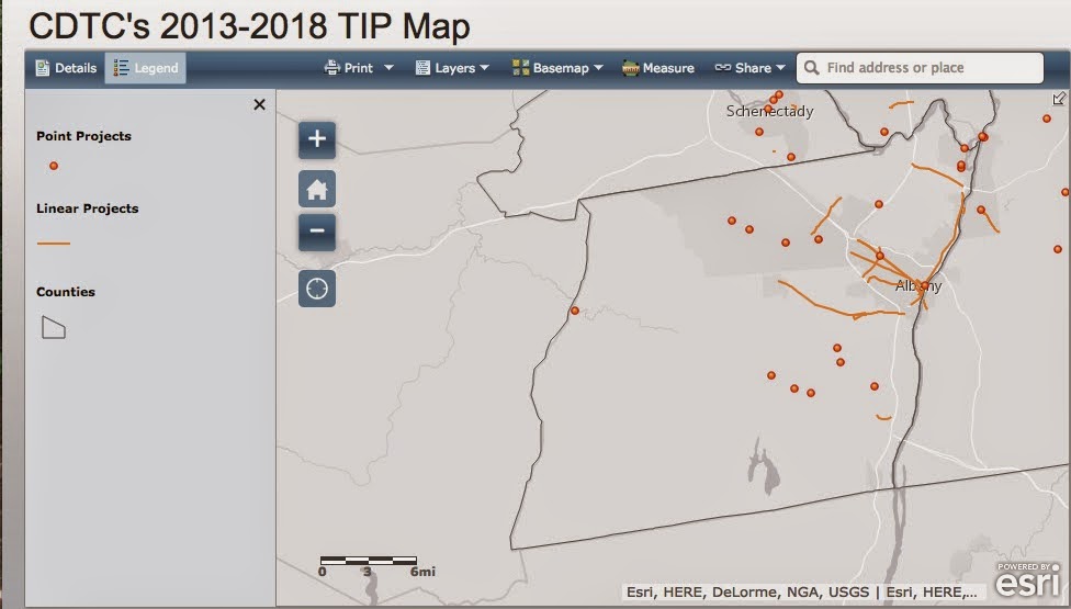
Map 2- "Capital District Transportation Committee's 2013-2018 Transportation Improvement Program (TIP) Map"
Link= http://www.cdtcmpo.org/mohhudns.pdf
Map 4- "Mohawk-Hudson Bike-Hike Map: Cohoes to Rotterdam Junction Section"
Link= http://www.cdtcmpo.org/mohhudew.pdf
Map 5- "CDTC's Bicycle Pedestrian Priority Network"
Link= http://www.cdtcmpo.org/networks/bikeped.pdf
Since many of these maps were created using arcgisonline, my goal is to find a way to transfer some of their layers into my own ArcMap document! Needless to say, I have quite a bit of work to do over the next couple of days!
Until next time,
-Christie
Tuesday, March 17, 2015
Project Update #3
Unfortunately, I still haven't heard back from the Albany Bike Coalition or the New York State Department of Transportation. That said, another week has gone by without making any progress on my actual map. My hope is that I will be able to obtain some information after making couple of phone calls. If not, I may have to start getting creative.
Despite the setbacks I've had so far, I discovered that there may be a way to upload old accident data from Albany County using a website called geocommons.com. Although I didn't have time to experiment with the website today, I will do some exploring before next week.
Despite the setbacks I've had so far, I discovered that there may be a way to upload old accident data from Albany County using a website called geocommons.com. Although I didn't have time to experiment with the website today, I will do some exploring before next week.
Tuesday, March 10, 2015
Project Update #2
Well, here I am again. The past week went by real fast, but I did get the chance to make a little progress on my project. Although I still have to email the New York State Department of Transportation, I contacted the Albany Bicycling Coalition yesterday to ask for any available maps of the current bike routes in Albany County. Over the last few days, I also looked up some background information on Albany County's biking projects. While doing this background research, I discovered that the City of Albany actually has a master bike plan (for more information, click the link below). By next week, I hope to have at least some data on the current bike routes so that I can post a map for you all to see!
https://docs.google.com/a/uhls.lib.ny.us/viewerurl=http://www.cdtcmpo.org/linkage/materials/albbikeplan/present2.pdf
https://docs.google.com/a/uhls.lib.ny.us/viewerurl=http://www.cdtcmpo.org/linkage/materials/albbikeplan/present2.pdf
Tuesday, March 3, 2015
Project Update #1
At this point in time, I have not made much progress on my course project since the last post. I went on a Habitat For Humanity trip to South Carolina over spring break, so my time to work on the project was very limited. By now, I was hoping to have at least some data sets from the New York State Department of Transportation as well as information about the current bike routes in Albany County. So much for that! Instead, I think I will push my project work plan back a week. Over the next few days, I plan on sending some emails out to obtain the data I need.
Friday, February 20, 2015
Project Proposal
A Safer Green: Assessing The Safety of Cycling Routes In
Albany County, NY
2. http://www.latimes.com/business/autos/la-fi-hy-ihs-automotive-average-age-car-20140609-story.html
3. http://www.census.gov/prod/2011pubs/acs-15.pdf
4. http://www.pbs.org/newshour/bb/statistics-reveal-america-bikes-work/
Dr. Katherine Meierdiercks
Siena College
Loudonville, NY 12211
February 20th, 2015
Introduction
According to the most recent IPCC assessment1,
transportation accounts for approximately 14 percent of all anthropocentric
greenhouse gas emissions in the world today. Air travel and commercial trucking
make up a significant portion of these emissions. However, when looking for
ways to decrease the transportation industry’s environmental impact, it is also
important to consider smaller sources of greenhouse gases. Personal vehicles
are one example.
With nearly 253 million2 cars navigating U.S
roads and just over 86%3 of the country’s citizens making a solo
drive to work everyday, it is clear that utilizing alternative modes of
transportation can help decrease America’s carbon footprint. Moreover, in large
cities and areas where the average commute is less than 10 miles long, biking
to work is a very feasible green alternative. Many Americans are beginning to
recognize this. In fact, a short segment broad casted by PBS last May pointed
out that the number of U.S. citizens who bike to work has increased by nearly
60%4 within the last 10 years! While this is a positive step in the
right direction for both bike enthusiasts and environmentalists alike, one must
ensure that participating citizens are safe. After all, different areas across
the country vary significantly in terms of their bike-friendliness.
Objectives
The main goal of this project is to assess the overall
safety of pre-existing bicycling routes in Albany County, NY. To make this
assessment, several other key objectives will have to be met:
1) Locate where cyclist accidents occurred in Albany
County from 2010-2014
2) Identify where current bicycling routes exist
3) Gather information on the roads where accidents
occurred
4) Examine the current traffic patterns of different areas in Albany County
4) Examine the current traffic patterns of different areas in Albany County
5) Determine whether accidents that occurred happened on
the current bike paths
Methodology
Step 1: Gather all
necessary datasets from the NYS Department of Transportation
Step 2: Convert
accident locations into GPS coordinates
Step 3: Create
necessary layers:
a) Locations where the accidents occurred (points)
- Each point will be colored based on the year of occurrence
- Each point will reflect the severity of the accident that
occurred there
b) Current roads, bike paths and bike routes in Albany
Country (lines)
- Different road types will be designated by their own
symbology
c) Traffic densities of the different townships throughout
Albany County (polygons)
Step 4: Create an
attribute table that contains relevant statistics on each accident.
Step 5: Use ESRI
ArcGIS software to create a comprehensive map of Albany County’s bike routes
and the locations of bicycling accidents that occurred in the area between 2010
and 2014.
Data Sources
·
Accident Data (To be obtained from NY State DOT data)
·
Traffic Data (To be obtained from NY State DOT and/or
NY State DMV)
·
ESRI Data and Maps (2010) [Download]. ESRI, Inc.,
Redlands, CA.
Tentative Work Plan
Week of
|
Tasks Completed
|
2/23 - 3/1
|
Obtain accident data from NYS DOT
|
3/2 - 3/8
|
Convert accident locations to GPS Coordinates
|
3/9 - 3/15
|
Begin creating map in ArcMap
|
3/16 - 3/22
|
Continue to work on map layers (points, lines, polygons);
Start making the attribute table
|
3/23 - 3/29
|
Edit map symbology; Continue working on attribute table
|
3/30 - 4/5
|
Clean up map layout; Write introduction for poster
|
4/6 - 4/12
|
Digital map finished in ArcMap; Write methods and objectives section for
poster
|
4/13 - 4/19
|
Write analysis section and begin formatting poster
|
4/20 - 4/27
|
Make finishing touches on poster; Print poster
|
Deliverables
1) A digital map stored
as an ArcMap shapefile
2) A large, colored poster containing a printed version of my
map as well as an assessment of the safety of Albany County’s bike
routes
References
1. IPCC, 2014: Summary for Policymakers. In: Climate Change 2014: Mitigation of Climate Change. Contribution of Working Group III to the Fifth Assessment Report of the Intergovernmental Panel on Climate Change [Edenhofer, O., R. Pichs-Madruga, Y. Sokona, E. Farahani, S. Kadner, K. Seyboth, A. Adler, I. Baum, S. Brunner, P. Eickemeier, B. Kriemann, J. Savolainen, S. Schlömer, C. von Stechow, T. Zwickel and J.C. Minx (eds.)]. Cambridge University Press, Cambridge, United Kingdom and New York, NY, USA.
2. http://www.latimes.com/business/autos/la-fi-hy-ihs-automotive-average-age-car-20140609-story.html
3. http://www.census.gov/prod/2011pubs/acs-15.pdf
4. http://www.pbs.org/newshour/bb/statistics-reveal-america-bikes-work/
Monday, February 9, 2015
An Introduction
Hi everyone! My name is Christie Macfarlane and I am a Junior Environmental Studies major at Siena College. Over the next few months, I will use this blog to document my progress on a course project for my GIS class. Stay tuned for further updates! :)
Subscribe to:
Comments (Atom)